Our talented team are often asked to talk at events. Many local history group have asked about how we produced the book and how the map technology works and we do love to talk all things book and map!
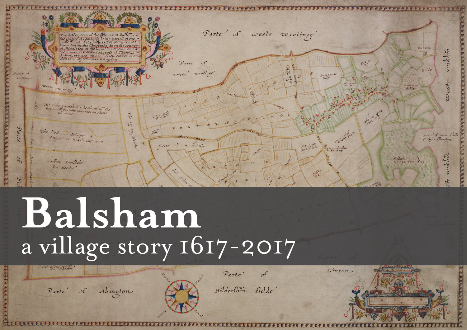
Dr Seppe Cassettari was more than happy to oblige at a meeting of the Linton and District Historical Society in February. Seppe opened his talk based on the 1617 Charterhouse Map of Balsham, with its beautiful cartouches, stressing how fortunate we were to have not only this early map, but a copy produced later in 1791. This later map, produced in book form enabled the names of those working the strips of land throughout the parish to be transcribed and thus create a database; consequently producing a colourful modern version.
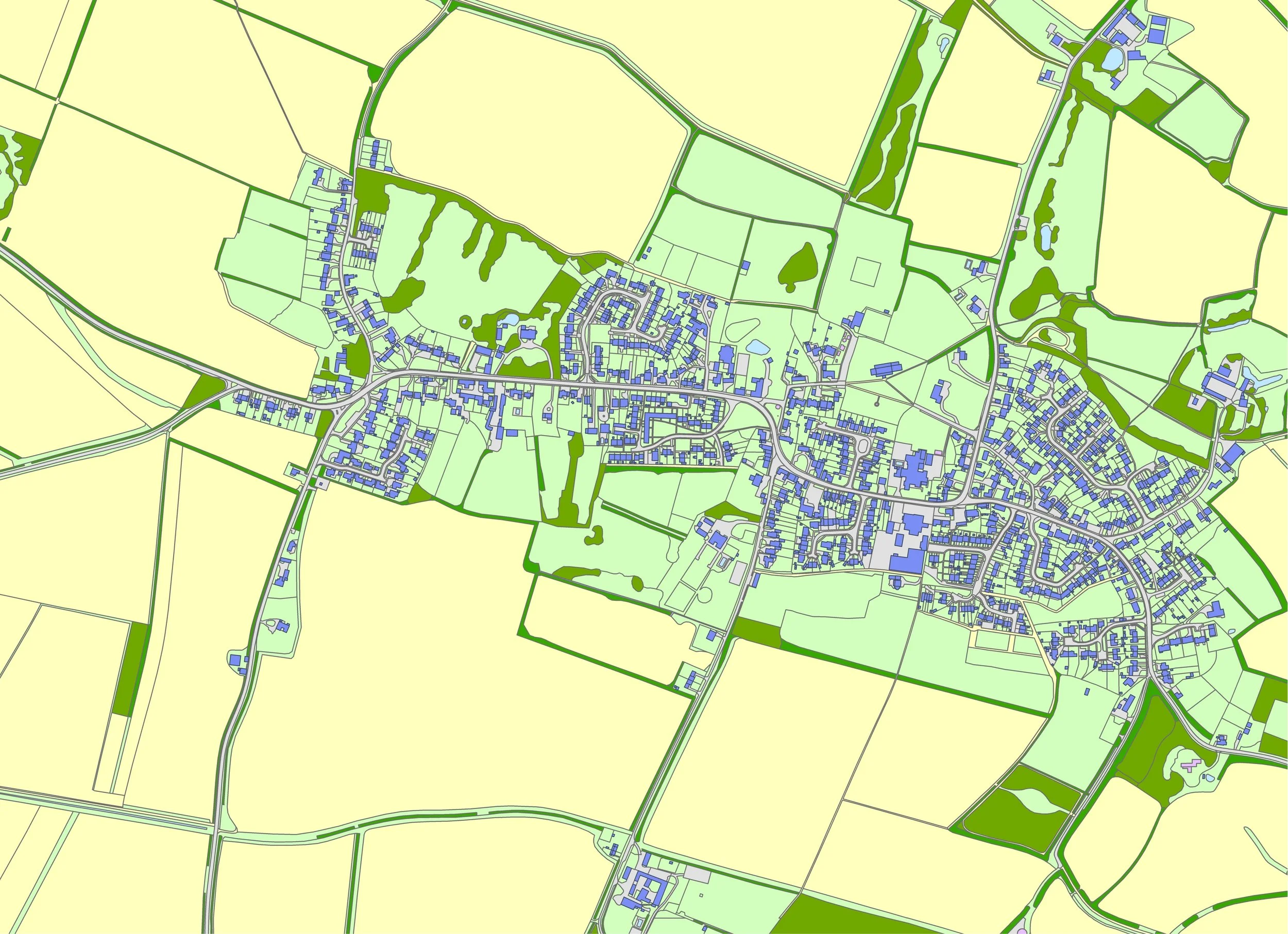
Using maps of Balsham throughout the centuries, it was also possible to produce a timeline of buildings to show the expansion of the village, again using different colours. Maps from 1801 - 2008 clearly shows the evolution of the village, with the greatest expansion coming during the 1960’s. An 1874 hand drawn map listed all the residents, which meant names could also be included.
Seppe was able to show just how accurate the 1617 map was by comparing it with a modern aerial survey. It is interesting to note many of the footpaths and by-ways used by walkers today can be traced back to the original 1617 map.
If you’d like us to talk to your group, please do get in touch. Both Seppe and our book designer Berenice are experience speakers and happy to talk about maps or getting your book into print respectively.