The Great Balsham Boundary Walk 2015
The idea for Beating the Bounds of the village to raise funds for the new Community Room in the Church and for the Balsham Map Project came about in late Summer of 2014 with Dick Paden and Peter Neale volunteering to organise the event.
Beating the Bounds is a custom dating from Anglo Saxon times and still enshrined by law to permit the priest and church wardens accompanied by the young boys of the parish to beat the parish boundary markers (and also sometimes the boys themselves!) with green willow boughs to make them remember. The event, usually held in Rogation Week, was to ensure that the boundary knowledge was passed on to younger generations and that land had not been taken by the neighbours thus reducing the taxes payable to the church. Prayers and blessings for the lands and harvest were part of the custom and accompanied by much revelry and celebrations. Since 1860 the Bounds can only be legally beaten every third year or longer.
It was quickly decided that we didn’t need to beat young boys and a simple clockwise perambulation of the boundary would make a great day’s walk and so the Great Balsham Boundary Walk was born. Peter, with his local farming knowledge, was the key player in contacting local land owners to seek their permission to walk the boundary over their land.
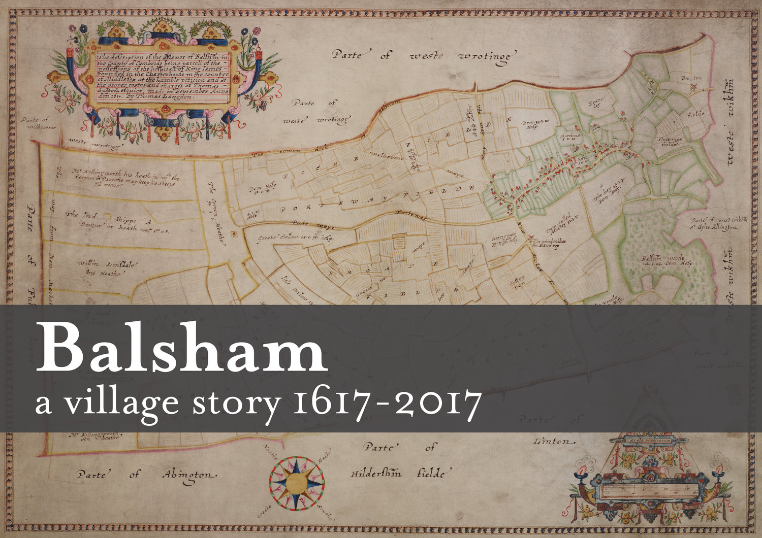
After many months of planning, finally, on Sunday Sept 6th in glorious weather 107 walkers (and over 20 dogs!) Beat our Parish Boundary to raise money for the toilets and community room in Holy Trinity Church and to support the Balsham 1617 Map Project. This project will celebrate in 2017 the first detailed map of the village compiled in 1617 by publishing a commemorative historical book for every household in the village. Walkers were across the full age range with many coming from Balsham but there were also good numbers from adjoining villages who had seen our posters.
The boundary of the parish is over 13 miles long, encompasses sections of the Fleam Dyke and the Roman Road and on that sunny day gave stunning views over Cambridgeshire with the unique opportunity to walk over private land and also visit the highest point in the county!
There were three walks of differing lengths all starting at the Institute and more than 25 walkers completed the full distance with the fastest taking well under 5 hours . The entire route was off road and was signed and marshalled by volunteers with the use of radios from the Cambridgeshire Raynet Group.
The organisers are especially grateful to all those who took part either walking or in the many supportive roles and in particular those landowners whose land the parish boundary crosses and not least of all those sponsors in time and money – their contributions made this event such a success. The total raised to date exceeds £1300.
Dick Paden
12th Sept 2015